Day 1

Students understand North, South, East, and West on maps and on the globe.
Students use a compass comfortably.
Students use those skills to complete a scavenger hunt outdoors.
Students use a compass comfortably.
Students use those skills to complete a scavenger hunt outdoors.
Day 2
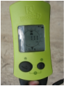
Students learn how GPS technology communicates with satellites to pinpoint a location.
Students understand longitude and latitude as a way of designating locations on the globe.
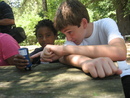
Students use GPS technology to find hidden geocaches outdoors.
Students understand longitude and latitude as a way of designating locations on the globe.
Students use GPS technology to find hidden geocaches outdoors.
Day 3
Students hide geocaches outdoors in small groups for their peers to find.
Day 4

Students use their knowledge of GPS technology to discover multi-caches, geocaches with more than one step before the final location.
Day 5
Students review the material they have learned over the course of the week.
Students combine their understanding of GPS technology, compasses, and multi-caches to participate in a longer outdoor treasure hunt involving both compasses and GPS technology.
Students combine their understanding of GPS technology, compasses, and multi-caches to participate in a longer outdoor treasure hunt involving both compasses and GPS technology.
